 Knowledge Centre
Drains Plans: A Guide to Drainage Plans for Your Home
Last Updated: 28 October 2026
Quick Summary
Drains plans are scaled drawings that map every underground pipe, gully, inspection chamber and manhole serving a property, including flow direction and pipe depth. You can find them in your purchase pack, local authority building control records, water company records or through a measured survey.
- A drains plan covers private pipework within your boundary, while a sewer plan covers the public network.
- Check the scale, follow the flow arrows, read the invert levels and match the drawing to the ground.
- A drainage plan for planning permission must show how foul and surface water will be managed.
- Gather your deeds and old plans, define the scope and confirm the approval route before commissioning.
- Expert design pays off where fall is limited, a public sewer crosses the plot or the site is in a flood risk area.
Table of Contents
- What a Drains Plan Actually Shows
- Common Drain Issues a Plan Helps You Spot
- Drainage Plans for My House: Where to Find Them
- How to Read a Drainage Plan
- The Drainage Plan for Planning Permission
- When Professional Drainage Design Pays Off
- Commissioning Your Drains Plans
- Frequently Asked Questions
What a Drains Plan Actually Shows
A drains plan is a scaled drawing that maps every underground pipe, gully, inspection chamber and manhole serving a property, together with the direction of flow and the depth of each run.
Most people meet their first drains plan at the worst possible moment: a solicitor asks for one during a house purchase, or a builder asks where the pipes run and nobody can say.
A good plan shows you five things:
- The route of every drain, drawn to scale
- Pipe sizes and the material used
- Chamber and manhole positions, with cover levels
- Invert levels, which tell you how deep each pipe sits
- Flow direction, so you know which way waste travels
The difference between a drains plan and a sewer plan
A drains plan covers the private pipework within your boundary. A sewer plan covers the public sewer network that your private drains connect into, and it is usually held by the water company rather than the homeowner.
That distinction matters more than it sounds. If your extension crosses a public sewer, you are dealing with a different set of rules and a different approval route than if it only crosses your own drains.
If you need to track down the public record for your property, our guide on how to find sewer maps for planning walks through the request process step by step.
Common Drain Issues a Plan Helps You Spot
- Shared drains. Pipework serving two or more properties carries different legal responsibilities than pipework serving one.
- Illegal connections. Rainwater wrongly plumbed into the foul system, or the reverse, shows up clearly on a well-drawn plan.
- Undersized runs. Older pipework that was fine for a small household struggles once you add a bathroom or an extension.
- Shallow cover. Pipes sitting close to the surface limit where you can dig, plant or build.
- Blocked or collapsed sections. A survey overlaid onto the plan shows exactly where the failure sits.
If you already suspect trouble at home, our article on identifying drainage problems in older properties covers the warning signs to look for alongside the plan.
Drainage Plans for My House: Where to Find Them
Drainage plans for my house usually come from one of four places, and the right one depends on how old the property is and what has been built since.
Start with these sources:
- Your purchase pack. Search the documents you received when you bought the property.
- The local authority. Building control records often hold plans deposited during past works.
- The water company. They hold records of public sewers and often the connections into them.
- A measured survey. If no reliable record exists, a surveyor can produce an accurate plan on site.
Older properties are the awkward ones. Records get lost, extensions get built without notification, and what survives may not match what is actually underground.
How to Read a Drainage Plan
Reading a drainage plan comes down to four habits: check the scale, follow the flow, read the levels, and match the drawing to the ground.
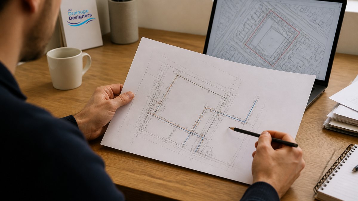
Work through it in this order:
- Scale. Confirm what the drawing represents. A plan at 1:100 shows far more detail than one at 1:500.
- Flow arrows. These tell you which way waste travels and therefore where a blockage will sit.
- Invert levels. These are the heights of the inside bottom of each pipe. The difference between two invert levels gives you the fall across a run.
- Symbols. Circles usually mark chambers or manholes; lines mark pipe runs; annotations give size and material.
- North point and boundaries. These anchor the drawing to the real site.
The thing nobody tells you about reading a plan is that the numbers matter less than the relationships. A pipe at a given depth means little on its own. What matters is how it sits relative to the foundations, the boundary and the next chamber along.
The Drainage Plan for Planning Permission
A drainage plan for planning permission is the drawing that shows how your development will manage surface water and foul water without increasing flood risk or overloading the network. Local planning authorities expect it to be clear, current and consistent with the rest of your application.
Most applications need to address:
- How foul water will connect to the existing network
- How surface water will be managed, often through sustainable drainage
- Whether the site sits in a flood risk area
- Whether the proposals affect any public sewer or ordinary watercourse
The Lead Local Flood Authority is usually consulted on surface water strategy, and their requirements vary between authorities.
Our step-by-step guide to getting planning permission for drainage sets out the full process, including what each stage requires.
When Professional Drainage Design Pays Off
These situations tend to justify expert input:
- The site has limited fall, so levels need careful design
- A public sewer crosses the plot
- The property is in a flood risk area
- The local authority has already raised drainage concerns
- The scheme needs sustainable drainage features
- Multiple properties share pipework
For a fuller look at the trade-off, read our piece on whether professional drainage design is worth it for home renovations.
Commissioning Your Drains Plans
A sensible process looks like this:
- Gather what you have. Deeds, old plans, survey reports, any correspondence with the council.
- Define the scope. Is this a record of what exists, a design for new work, or both?
- Confirm the approval route. Ask which authority will review the design and what they expect.
- Agree deliverables. Drawings, levels, calculations, and any supporting statement.
- Check ownership and handover. Confirm you can pass the work to others later if you choose.
Our walkthrough on getting a drainage design quote explains what to have ready before you ask for one.
| Stage | What Happens | What You Should Receive |
|---|---|---|
| Brief | Scope and constraints agreed | Written scope of works |
| Survey | Site levels and existing drainage recorded | Measured survey drawing |
| Design | Pipe routes, levels and SuDS worked up | Design drawings and calculations |
| Approval | Submission to the local authority | Submission pack and responses |
| Handover | Final issue to you | Full drawing set you own |
Drainage paperwork has a habit of surfacing at the least convenient moment, and the cost of a wrong assumption sits underground where you cannot see it. The Drainage Designers work with homeowners, architects and developers from first site visit through to local authority approval, with nationwide coverage and a transparent, ethical customer charter. We handle flood risk assessments and sustainable drainage design. Get in touch with The Drainage Designers.
Frequently Asked Questions
Do I need a professional drainage design for a home project?
For a small extension that connects to existing drains, you may only need a basic layout. For new builds, basements, or sites near flood zones, professional drainage design is usually essential. A designer confirms pipe sizing, falls, and SuDS compliance, and prepares drawings that satisfy the local authority and Lead Local Flood Authority. It reduces the risk of conditions or rejection during planning.
Who can prepare a drainage plan?
A civil engineer or drainage design specialist typically prepares the plan, working alongside your architect. They need site levels, soil information, and the location of existing sewers. Some homeowners use the water company's asset records as a starting point, but those records are not a substitute for a designed plan, especially where planning permission requires detailed drawings.
Are drainage plans the same as sewer plans?
No. A sewer plan shows public sewers and adopted assets, usually obtained from the water authority. A drainage plan covers the private drainage serving your property, including pipe runs, inspection chambers, gradients, and connections to the public system. You often need both to understand how your site connects to the wider network.
When should I get a drainage plan for a building project?
Commission it early, ideally before submitting your planning application. Drainage is a common reason applications are refused or delayed with conditions. Getting the plan in place alongside your architectural drawings lets you address levels, SuDS, and connection points before the council reviews the scheme, which saves time later.